
Following our post on 77 Maple Street, many people asked how they could do research on their own homes. That is the best question of all. This post will inaugurate a new series on sources that you can use from your home computer to research the history of your own house, or any other topic in Melrose history that tickles your fancy.

Let us begin with maps. There are two available types of maps of Melrose that are useful for home research: the Middlesex County atlas maps, and the Sanborn Fire Insurance maps.

Currently available atlas maps were published in 1875, 1889, and 1906. There was an earlier atlas published in 1852, but it is not detailed enough to be useful. The atlas maps are not as precise as the fire insurance maps, but they provide a critical detail the other maps lack: each structure is labeled with the name of the property owner. This is extremely useful in cases where the trail of house ownership recorded in deeds becomes ambiguous or goes cold entirely. Note, however, that the name of the owner is not necessarily the name of the people who actually resided there. These maps are available for viewing at the private historicmapworks.com website; if you want to download them, you must pay: http://www.historicmapworks.
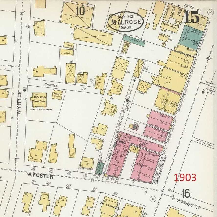
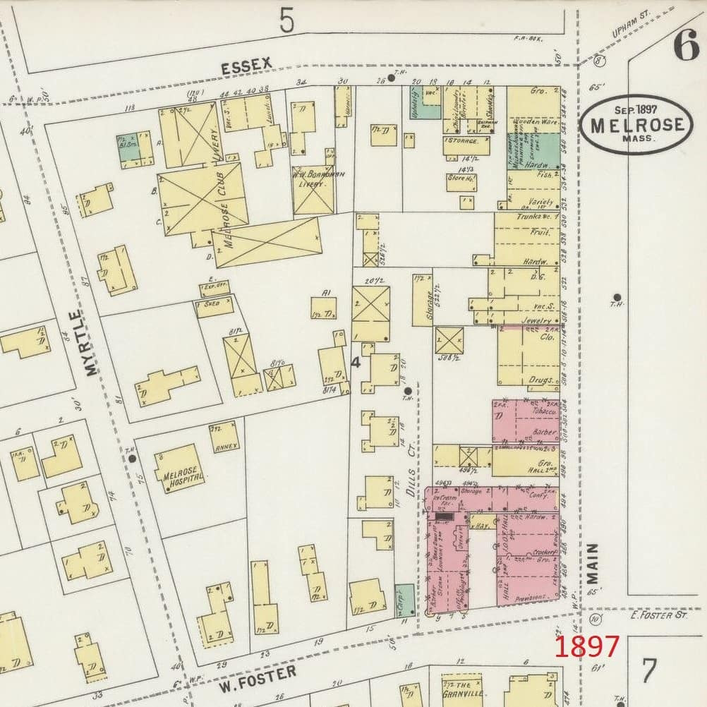
The fire insurance maps do not give you the names of owners, but they are extremely detailed, containing every bit of information that might have impacted fire insurance costs. They tell you the materials used in construction, the number of stories in each structure, and the specific use of each commercial or industrial building. They were almost all uploaded by the Library of Congress last spring, and are available for free viewing and downloading on their website: https://www.loc.gov/maps/?fa=

To give you a sense of how these maps work, below is a series of images from all of these maps showing the evolution of the Shaw’s parking lot block between 1875 and 1923.


No comments:
Post a Comment